
Maps, site and floor plans, and 360° visualisation
Being able to visually manage your data provides unparalleled context. No third party software is required simply run your plans in your browser making it simple and cost effective.
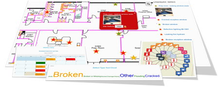
Intuitively managing ‘at-a-glance’ the location of assets, the status of defects, maintenance requests, condition survey results and capital projects etc saves you time and money.
Using site and floor plans and photospheres as the schematic background for your data makes the contextual information of your site visible at a glance. This supports better decision making and more effective site and facilities management.
Manage your buildings’ assets, defects, jobs, documents, utility services and other information in its proper locational context.
Manage reactive maintenance on floor plans
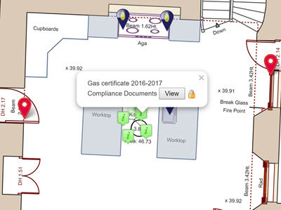
Manage assets and documents on floor plans
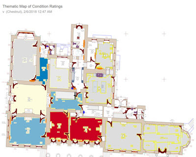
Engage stakeholders with easy to understand thematic maps
Step into 360° for true photo-realistic data management
Optionally integrate 360° photospheres with your plans to get a 2D ‘bird’s eye’ view on the plan combined with a 360° view in the photosphere. You can pan and zoom the image and virtually walk your buildings and estates. No expensive or difficult to use hardware is required.
This is also a very efficient way to perform quick visual surveys for asset and inspection purposes.
Sharing this visualisation with external contractors means they have a much better idea of the work to be performed, its location and any potential hazards or access issues. This increases the likelihood of first time fixes saving costs and reducing disruption.
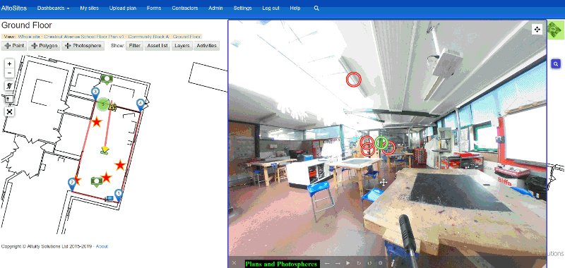
Pan, scroll and virtually walk your estate with photospheres